
West Farleigh Walks
Explore Kent
Explore Kent have created a West Farleigh River Walk including the River Medway, All Saints Church and Farleigh Green. To view their route please click here to download it.
Local Insight
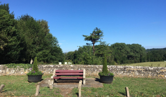
Most of our walks start from the bench next to the Tickled Trout pub, though of course can be picked up at any point along the route (The pub is also useful for refreshments and parking!). We aim for a loop but sometimes the calculations may finish just short of there. Short walks at the top of the page, getting longer as you scroll down.
PDFs per walk added for directions to print and take with you for guidance.
Pace for guidance is roughly a 15-16 minute mile.
If you have any interesting walks to share, please email Bloom@TheFarleighs.co.uk. If you can map them on Strava, even better! Send us your photos too and we will add to the image galleries.
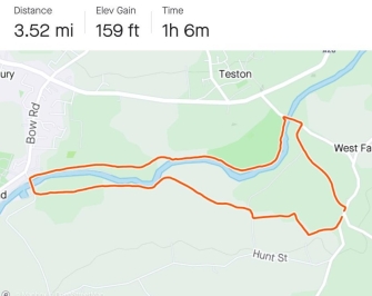
Tutsham to All Saints
Some of the highlights of the village, passing the Medway, WF Cricket Pitch, All Saints Chuch and back past the Tickled Trout.
Also passed on this route are 2 of the local Pill Boxes used in WW2.
and see images of the walk here
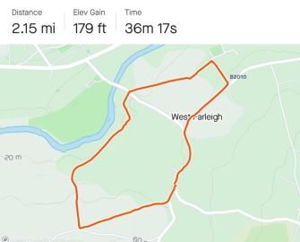
West Farleigh Green to Quarry Wood
Starting this time at the Good Intent pub, walk through Farleigh Green to Quarry Wood and back.
and watch a film here from March 2020
Shingle Barn
This was a slow walk with a young child, but lots to see along the way. Up Ewell Lane, through Clockhouse apple orchards, past the pigs, up 'Chestnut Walk' in Quarry Wood, up to Shingle Barn for a stop on the picnic table. Down through fields of wheat, then raspberry fields to Hunt Street and onto Tutsham, 'hello' to the Horses, over the Ewell Stream and up to the bench on lower road.
Wateringbury Loop
This is a gentle easy walk when heading first to Wateringbury. However if walked in reverse crossing first at Teston Bridge it proves more challenging for the long gradient up hill to Tutsham Farm at the end.
Up to Tutsham, along the Medway Walk to Wateringbury Station, back along the tow path to Teston Country Park. Over the bridge, up Mill Lane back to base.
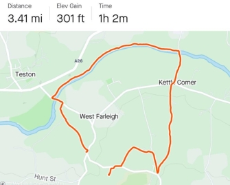
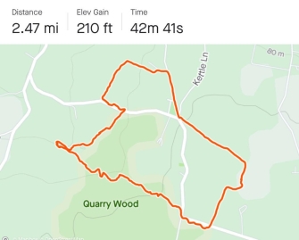
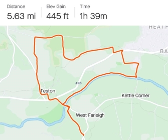
Kettle Bridge Loop
Very plesant river walk to Kettle Bridge (aka Barming Bridge and St Helens Bridge). However a steep section up hill out of the Medway valley on St Helens Lane and then leading into Kettle Lane to the green at West Farleigh before descending on its return through the hollow onto Ewell Lane.
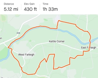
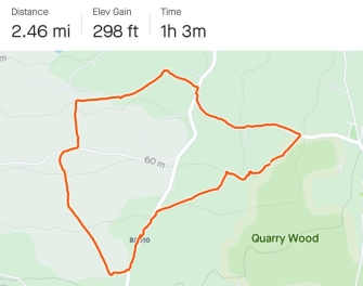
East Farleigh Bridge Loop
River walks with an inland detour through orchards from Kettle Bridge to East Farleigh Bridge then cross country back to the middle of Kettle Lane and across the permissive footpath to Charlton Lane and Ewell Lane.

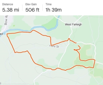
East Farleigh Bridge Extension (via Fant)
The same as the walk above but with a very plesant extension to Fant adding 1.5 miles on.
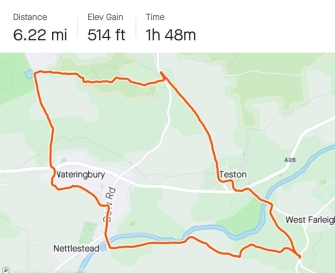
Wateringbury, Fields and Woods
Similar at the start to the Wateringbury Loop, however don't cross over the River Medway this time but take the footpath straight up hill leading to Hunt Street, crossing over into Small Profits, through Fox Pitt, Quarry Wood via The White House and back through the wood to return to base.
Oaken Wood
Medway path to Kettle Bridge, up to St Margaret's Church Barming, fields and woods to North Pole Road and back down Livesy Street to Teston.
Piezen Well
A really pretty walk, starting along Hunt Street and then down through the fields to Bow Bridge, Medway Valley walk to Nettlestead Place, across to Piezen Well and a pretty waterfall. Back via the pond in Wateringbury and home.
Kings Hill and back
A surprisingly quick way to get to Kings Hill via Wateringbury. The return leg needs some work so watch this space for updates!
In brief - Medway Valley walk to Bow Bridge, turn right onto the Maidstone Road then shortly left onto a Bridgeway to the pond on Love Lane, continuing the footpath to Old Road, cross over and all the way to the top of Canon Lane, permissive footpath to the back of KH and try not to get lost in the woods...
Hunton via Dean Street
Raspberry fields of Clock House Farm, onto the Greensand Way, past Buston Manor to Hunton... then uphill! Some road walking up to Dean Street and across the fields home.
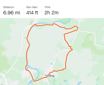
Yalding Loop
Along the river banks past Wateringbury until you reach Hempsted Lock by Yalding Station, then across the Lees, over Yalding Bridge and onto the Greensland Way at Vicarage Road - up hill To Shingle Barn Road!
Surprisingly this walk has less climbing up hill than the shorter walk above.
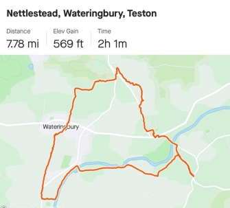
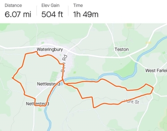
Nettlested, Wateringbury & Teston Tour
Following the Medway Valley Walk until you reach Nettlestead Place & Church, across the fields to Wateringbury pond on Mill Lane, up to Redhill Wineary and back through Teston.
and see images here
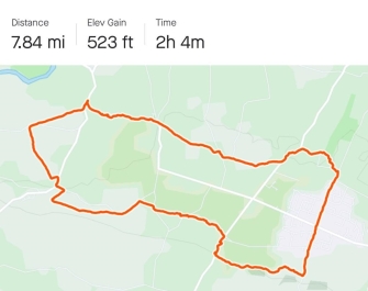
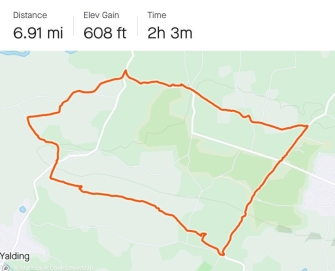
Coxheath via the Greensands Way
Out of the village via Shingle Barn, onto the Restricted Bridelway down hill towards Yalding but taking the first footpath across the top of the ridge. Along quiet country lanes and footpaths to reach the Greensands Way on Hunton Hill. Across to Westerhill Road, through the middle of Coxheath until Workhouse Lane, to the Horseshoes pub and back to West Farleigh Green.
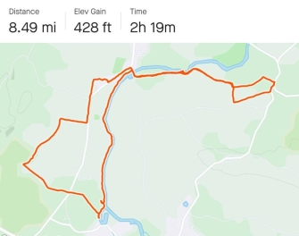
Greensands way towards Roydon Hall
We were aiming for Roydon Hall and St Michael's church on the hill... however realised half way in that we had set ourselves a bigger target than we had time for! We will aim for the full Roydon Hall route soon...
In brief, the Medway Walk until Hamsted Lock in Yalding, at the new houses take the Greensands Way over the railway track, over the fields, over the Maidstone Road, up to the woods and then take the farm track instead back to Nettlestead, repeating bow bridge.
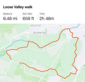
Loose Valley Walk
This is a 10 mile walk along the Medway Path to Tovil and then the Loose Valley Conservation trail to Loose (where we stopped at the Chequers Inn!) and home across Coxheath/Dean Street.
The Loose Valley is idilic, no signs that you are less than 2 miles from the centre of Maidstone.
Instructions to follow shortly.
| Visitor Counter: | |||||||
 |  |  | |  |  | ||